Sitenav has developed its first 3D Excavator Guidance Solution with the support of civil engineering professionals.
This solution is complemented by a suite of user-friendly field software designed for real-time work monitoring.
Sitenav has broadened its product range, introducing 3D machine control solutions for excavators and expanding into other machinery, including bulldozers, loaders, compactors, and survey rovers.
SITENAV’s primary objectives:
- Simplify drivers’ work
- Promote their autonomy
- Increase safety in the work area
- Increase productivity on the construction site
In the current economic climate, which is not favourable for investment, SITENAV’s solution is emerging as the ideal choice in a rapidly growing market, offering significant improvements in productivity and safety on job sites.
“SITENAV is a key player in 3D machine guidance in France. Building on this experience and reputation, we will be attending bauma 2025 for the first time, marking the official launch of our brand’s distribution in Europe and the USA. We are excited to replicate our success in these new target markets.”
David VINCENT Sales Manager.
SITENAV 3D Excavator is an easy-to-use software. This technology can be applied to all types of Excavators, Bulldozers, Loaders, and Compactors responding to all types of applications, and allowing monitoring of the job site in real time, even in large areas.
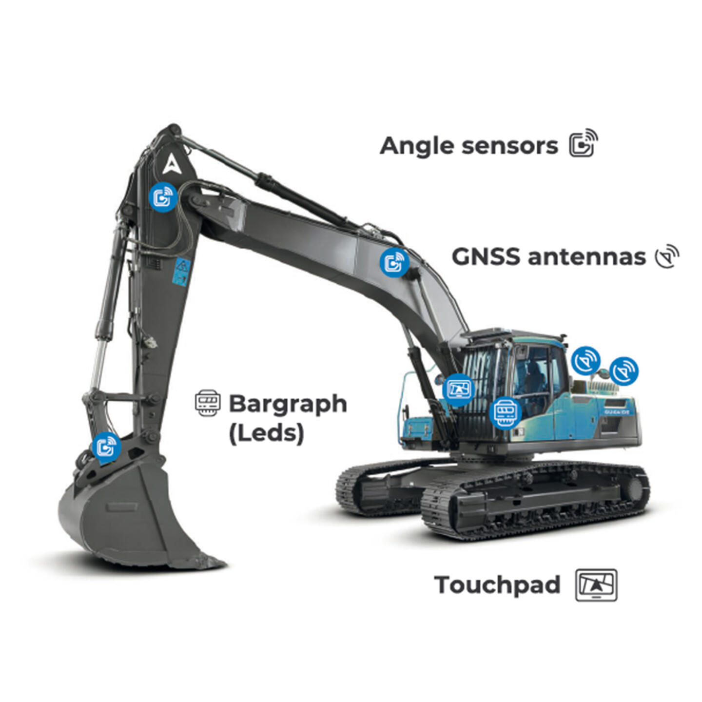
SITENAV 3D Bulldozer allows you to work on all kinds of simple or complex projects with a centimetre precision of +/- 2 cm: formwork stripping, adjustment work, floor finishing, and line following or earthworks with more productivity.
Getting started with our Bulldozer guidance system is straightforward and designed to be intuitive for drivers.
The 3D Pedestrian Kit is your field app to make easy surveys & stakeouts, projects, and job sites in real-time.
This pedestrian Kit will allow you to create a simple job site. The same controller can be used on the machine avoiding transferring files with all Microsoft Windows-based features advantages.
The DEPOLLUTION module is a complementary application to our 3D excavator guidance for the rapid identification of polluted materials from laboratory surveys. You can identify and classify polluted land, and contamination of ambient soil environments by creating mapping data in the form of a 3D mesh for well-defined extraction to reply to the eco-responsible commitments.
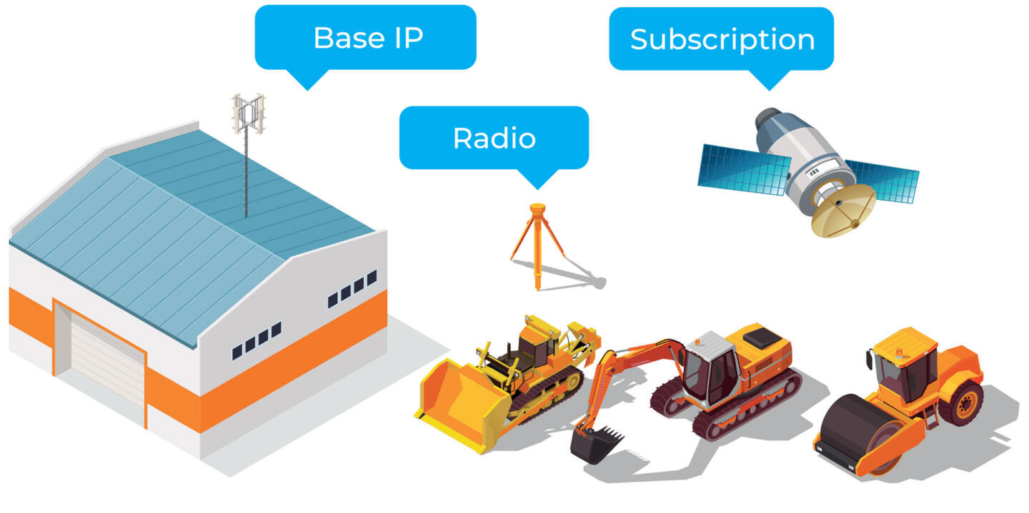
Choose your geolocation package according to your needs: for centimetre accuracy, choose between your own Base IP technology or a bespoke subscription.